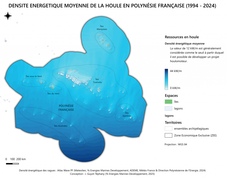
In 2023, Meteolien and Météo-France co-created the wave energy atlas of French Polynesia through 30-year modelling.
The Opendata Atlas Wave is now avaible on www.odatis-ocean.fr.
This tool is a mapped databased of wave energy resources. This quantifies, for the first time, the wave energy production potentiel in French Polynesia in order to define the projects that could be deployed on a territorial scale.
Several indicators were studied:
- average significant heights,
- average energy fluxes,
- average energy periods
- 10-year return levels.
5 territories were studied in particular:
- The Society Islands
- The West Tuamotu
- The East Tuamotu + the Gambier islands
- The Marquesas Islands
- The Austral Islands
A total of 24 maps were presented.
Discover here the poster make for this project. It was presented at the Seanergy international event in Nantes in June 2024.
The project was co-financed by ADEME, the Polynesian Directorate of Energy and Ys Energies Marines Developpement.